More explanation regarding the 1910 Doomsday book
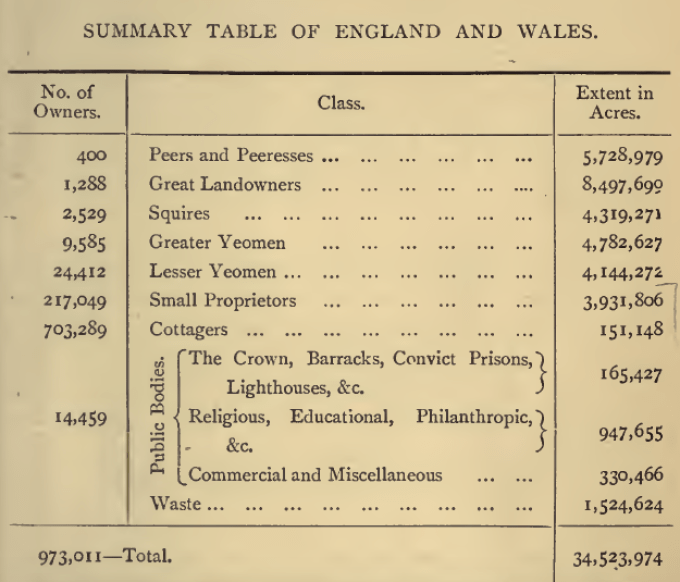
In the 1870’s a survey* was done to record the names of those who owned 3,000 acres or more in the UK. An interpretation of the survey by John Barrymore showed that 4,000 families owned over half the country and 95% of the population owned nothing.
In the early 20th century much land was still owned by a privileged few, who often got richer as their land increased in value with no effort on their part. This was beginning to be seen by many people as a social injustice. In 1909 the Chancellor of the Exchequer was David Lloyd George (who became Prime Minister in December 1916). His Liberal Government’s so-called 1909 ‘People’s Budget’ introduced a new tax on any increase in land values due to the State’s economic efforts rather than to landowners’ own efforts.

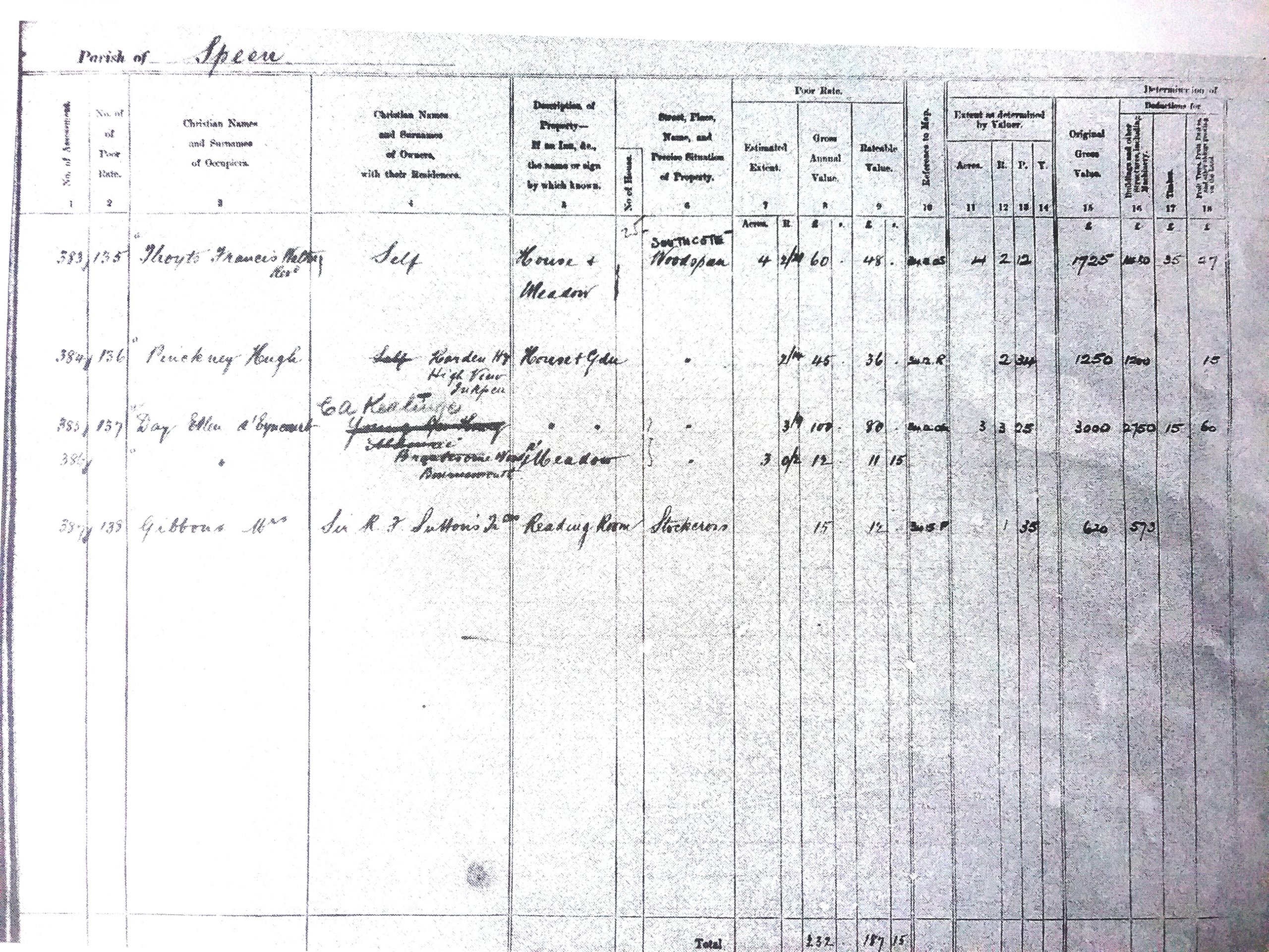
The survey is sometimes named after him or its other common name is the Domesday book. First, a valuation was made of all land in the United Kingdom, to fix the base line from which increases in value would be calculated. Each property was given a plot number, unique within its income tax parish, which was written on the relevant map. Two sets of plans were created. One set, those that were used as working documents in the course of the original valuation, are, where they survive, held at local archives. The survey took 5 years to complete. The other set of plans were created after the valuation was completed and these are held at The National Archive. and the description written in the related Field Book. The annotated maps where surviving are also available. The amount of detail varies but can give much information about the use and value of lands and buildings, and names of their owners and occupied.
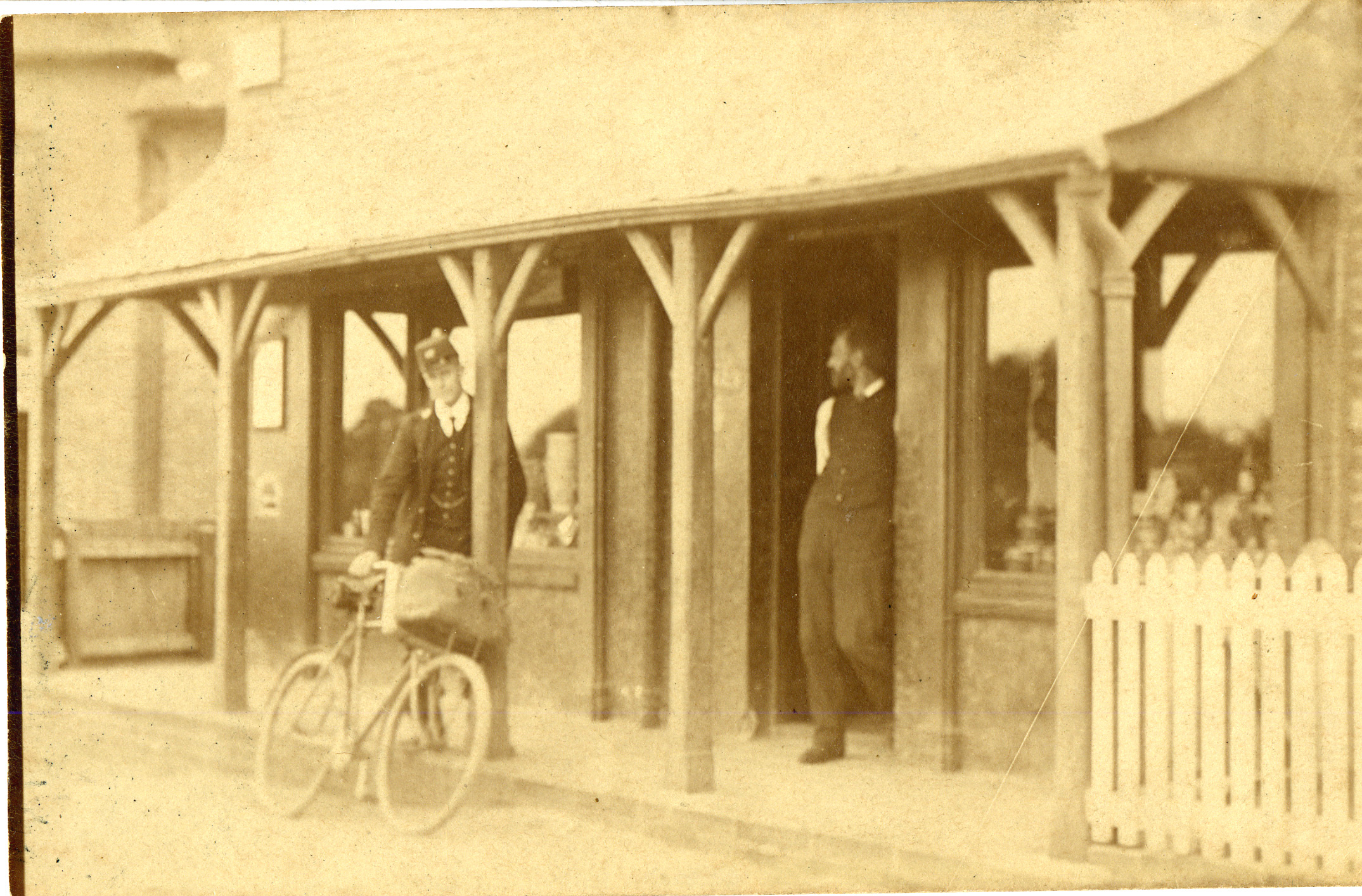
Here is an example showing the entry for the Post Office and Shop run by Mr Copeland.
SASHA has transcribed the information given in the working documents for the Stockcross area. These give a map and poor law reference, the name of the occupier the name and address of the owner ,and where it is situated and information on the size and rateable value composition of the property. Members may view by clicking on links below
334 to 405 1910 Doomeday click to view
406 to 526 1910 Doomesday click to view
527 to 699 1910 Doomesday click to view
Unfortunately we do not have the accompanying notated map to identify exactly which properties are being described. One day a visit to the National Archives might give us this further knowledge.
During WW2 a National Survey of land was done which was targeted at farming aims for information but at the same time gathered ownership information this can be seen at the National Archive but not on line. The new computerised Land Registry aims for comprehensive listing by 2030 and as of September 2019 they have reached 87% but this largely relies on land being bought and sold. So the last land to be registered is likely to be those huge estates that have been in the hands of single aristocratic families.
In this 21st century huge land holdings are owned by the Forestry Commission, corporate bodies and MOD but leaving that aside two- thirds of Britain’s 40 million acres are still owned by a tiny proportion (0.36%) of the population. Even with the increased house ownership of the last 60 years, the 24 million families who own an “urban plot” this only amounts to around 3 million acres. So things have changed very little.
*googlebooks.co.uk /Return of owners of land 1873 presented to both houses
Berkshire – population 196,475 inhabited houses 39,638 number of parishes 93
National Archives- Land use, valued ownership Valuation Office Survey 1910-1915 – Stockcross area OS map reference IR 126/7/179